Trail Walking Le Valtin - Col de la Schlucht - Photo

Col de la Schlucht

 Alfredy
Alfredy

User

© OpenStreetMap contributors
Length
Length
3.5 km
Max alt
Max alt
1258 m
Uphill gradient
Uphill gradient
123 m
Km-Effort
Km-Effort  
5.2 km
Min alt
Min alt
1139 m
Downhill gradient
Downhill gradient
123 m
Boucle
Boucle
Yes
Creation date :
2018-02-14 09:52:42.903
Updated on :
2018-09-05 14:47:41.551

(1 Reviews)

Walking
Walking
1h17
Difficulty : Very easy
Running
Running
45m
Difficulty : Easy
Mountain bike
Mountain bike
19m
Difficulty : Easy
Snowshoes
Snowshoes
1h17
Difficulty : Easy
Sled dogs
Sled dogs
30m
Difficulty : Easy

Scan this QR Code to open this trail in the SityTrail application

FREE GPS app for hiking

Logo SityTrail SityTrail

IGN / Geographical institutes

Download SityTrail from the App Store Download SityTrail from Google Play

Logo SityTrail SityTrail World

The world is yours!

Download SityTrail from the App Store Download SityTrail from Google Play Download SityTrail on Huawei AppGallery

About

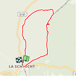
Trail Walking of 3.5 km to be discovered at Grand Est, Vosges, Le Valtin. This trail is proposed by Alfredy.

Description

Belle rando à  faire en famille. Beaux points de vue.

Elevation profile

Photos

Positioning

Country:
France
Region :
Grand Est
Department/Province :
Vosges
Municipality :
Le Valtin
Location:
Unknown
Start:(UTM)
352679 ; 5325317 (32U) N.

Comments

Please log in to post a review or rate the element


Trails nearby

Trail Walking Stosswihr - Tour du belvedere avec le passage sur les crêtes  - Photo
Walking
ocepee

Walking

Very easy
(2)
Stosswihr, Grand Est, Haut-Rhin, France
8.5 km | 0 m-effort
2h 28min
Yes
Trail Other activity Soultzeren - Totom 4 lacs - Photo
Other activity
dinozore

Other activity

Medium
(1)
Soultzeren, Grand Est, Haut-Rhin, France
15.6 km | 26 km-effort
4h 37min
Yes
Trail Walking La Bresse - Les 5 lacs autour du Hohneck - Photo
Walking
tiene

Walking

Very difficult
(1)
La Bresse, Grand Est, Vosges, France
21 km | 36 km-effort
7h 21min
Yes
Trail Walking Le Valtin - Les Hirschsteine - Photo
Walking
VacheKiri67

Walking

Difficult
(1)
Le Valtin, Grand Est, Vosges, France
16.1 km | 25 km-effort
6h 28min
Yes
Trail Walking Ban-sur-Meurthe-Clefcy - La vallée de Belbriette - Ban-sur-Meurthe-Clefcy - Photo
Walking
tracegps

Walking

Medium
(2)
Ban-sur-Meurthe-Clefcy, Grand Est, Vosges, France
9.8 km | 12.6 km-effort
2h 30min
Yes
Trail Walking La Bresse - Du Hohneck au Kastelberg par les Spietzkoepfe et le Sentier des Névées - Photo
Walking
tracegps

Walking

Very difficult
(3)
La Bresse, Grand Est, Vosges, France
7.6 km | 13.7 km-effort
3h 30min
Yes
Trail Walking Soultzeren - Tanet-Gazon du faing par lac vert et retour sommet du Tanet - Photo
Walking
ride-in-Elsass

Walking

Medium
(1)
Soultzeren, Grand Est, Haut-Rhin, France
10 km | 15.6 km-effort
4h 24min
Yes
Trail Snowshoes Le Valtin - raquettes  - Photo
Snowshoes
vathi54

Snowshoes

Very easy
(1)
Le Valtin, Grand Est, Vosges, France
6.6 km | 9.4 km-effort
3h 8min
No
Trail Walking Stosswihr - Le cirque glaciaire du Frankenthal - Sentier des Roches -Gps - Photo
Walking
GUIDE
Desrumaux

Walking

Difficult
(3)
Stosswihr, Grand Est, Haut-Rhin, France
9 km | 16.1 km-effort
4h 10min
Yes


Close
My subscriptions